
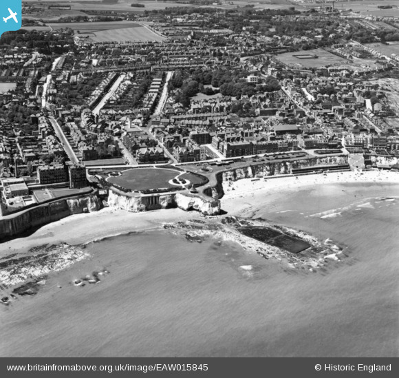
EAW015845 ENGLAND (1948). Victoria Gardens and environs, Broadstairs, 1948. This image has been produced from a print.
© Copyright OpenStreetMap contributors and licensed by the OpenStreetMap Foundation. 2024. Cartography is licensed as CC BY-SA.
Nearby Images (24)
EAW015845

EPW035457

EAW015844

EPW000344

EPW000611

EAW024845

EPW052894

EAW024846

EPW009185

EAW015846

EPW009184

EPW035455

EPW035459

EAW015847

EPW035456

EPW000609

EPW042844

EPW000607

EPW000605

EPW000606

EPW000118

EAW024847

EAW024848

EPW042846

Details
| Title | [EAW015845] Victoria Gardens and environs, Broadstairs, 1948. This image has been produced from a print. |
| Reference | EAW015845 |
| Date | 19-May-1948 |
| Link | |
| Place name | BROADSTAIRS |
| Parish | BROADSTAIRS AND ST. PETERS |
| District | |
| Country | ENGLAND |
| Easting / Northing | 639782, 167569 |
| Longitude / Latitude | 1.4443830804202, 51.356003206841 |
| National Grid Reference | TR398676 |


