
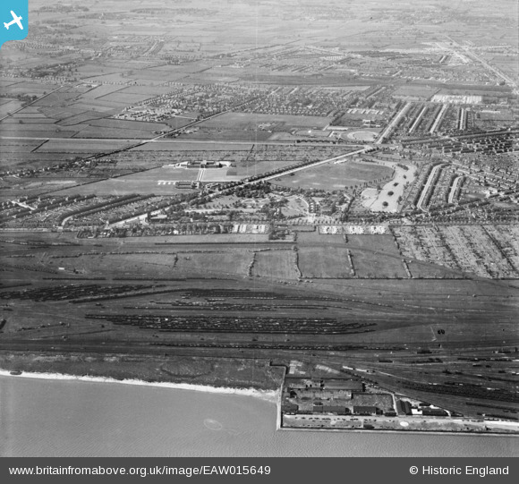
EAW015649 ENGLAND (1948). Pickering Park and Priory Yard Sidings, Gipsyville, 1948
© Copyright OpenStreetMap contributors and licensed by the OpenStreetMap Foundation. 2024. Cartography is licensed as CC BY-SA.
Nearby Images (4)
EAW015649

EPW036562

EPW036548

EPW036393

Details
| Title | [EAW015649] Pickering Park and Priory Yard Sidings, Gipsyville, 1948 |
| Reference | EAW015649 |
| Date | 18-May-1948 |
| Link | |
| Place name | GIPSYVILLE |
| Parish | |
| District | |
| Country | ENGLAND |
| Easting / Northing | 505601, 427040 |
| Longitude / Latitude | -0.39915718141473, 53.728829549535 |
| National Grid Reference | TA056270 |
Pins
 redmist |
Monday 18th of October 2021 02:40:36 PM | |
redmist |
Monday 18th of October 2021 02:39:41 PM | |
redmist |
Monday 18th of October 2021 02:12:51 PM | |
redmist |
Monday 18th of October 2021 02:12:30 PM | |
redmist |
Friday 11th of January 2019 06:10:40 PM | |
redmist |
Friday 11th of January 2019 06:08:15 PM | |
redmist |
Friday 11th of January 2019 06:05:07 PM |


