
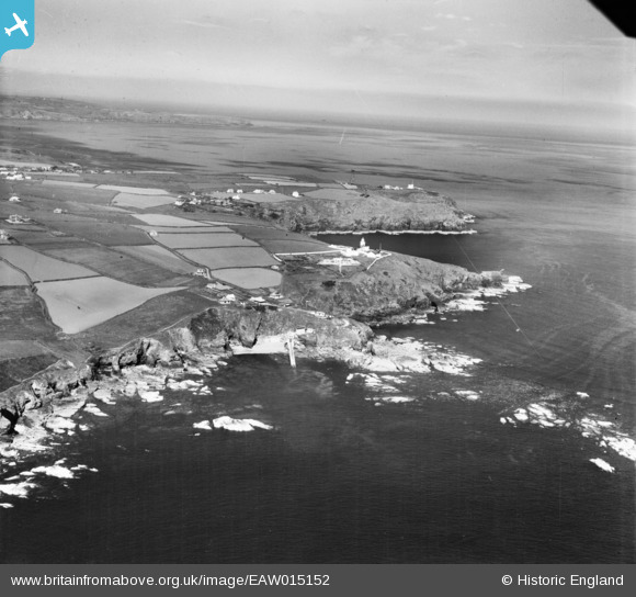
EAW015152 ENGLAND (1948). Polpeor Cove, Lizard Lighthouse and the surrounding coastline, Lizard Point, from the south-west, 1948
© Copyright OpenStreetMap contributors and licensed by the OpenStreetMap Foundation. 2024. Cartography is licensed as CC BY-SA.
Nearby Images (2)
EAW015152

EAW015151

Details
| Title | [EAW015152] Polpeor Cove, Lizard Lighthouse and the surrounding coastline, Lizard Point, from the south-west, 1948 |
| Reference | EAW015152 |
| Date | 29-April-1948 |
| Link | |
| Place name | LIZARD POINT |
| Parish | LANDEWEDNACK |
| District | |
| Country | ENGLAND |
| Easting / Northing | 169833, 11365 |
| Longitude / Latitude | -5.2093736107996, 49.957383564762 |
| National Grid Reference | SW698114 |
Pins
 Richalj |
Wednesday 12th of May 2021 05:41:20 PM | |
CornwallPhil |
Tuesday 17th of June 2014 11:42:18 AM | |
CornwallPhil |
Tuesday 17th of June 2014 11:40:03 AM | |
CornwallPhil |
Tuesday 17th of June 2014 11:38:24 AM |
User Comment Contributions
 Pen Olver Radar Station - Chain Home Low 16A |
 JMB |
Tuesday 21st of April 2015 01:01:00 PM |
Pen Olver CHL Radar Station |
CornwallPhil |
Tuesday 17th of June 2014 11:46:57 AM |


