
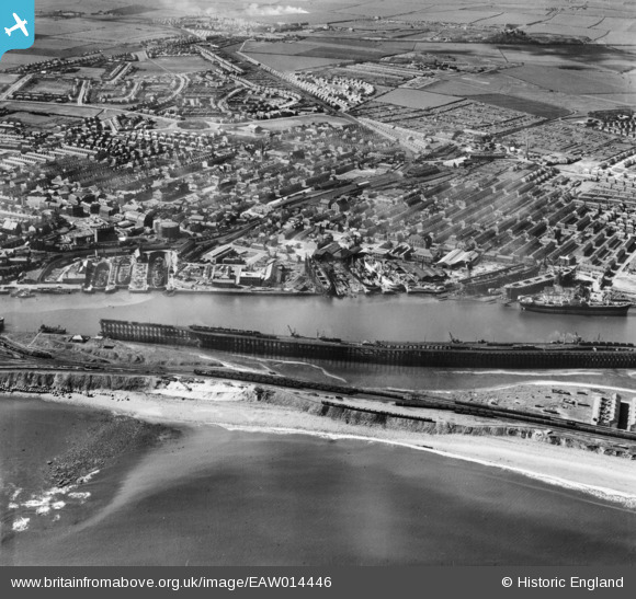
EAW014446 ENGLAND (1948). Blyth Harbour and the town, Blyth, 1948
© Copyright OpenStreetMap contributors and licensed by the OpenStreetMap Foundation. 2024. Cartography is licensed as CC BY-SA.
Nearby Images (26)
EAW014446

EAW013074

EAW013063

EAW014453

EAW014454

EAW014447

EAW013064

EAW014455

EAW014445

EAW014456

EAW014449

EAW013068

EPW048840

EPW019752

EAW014452

EAW014451

EAW014450

EAW013073

EAW013075

EAW014458

EAW013066

EPW048830

EAW013070

EPW019747

EPW019748

EAW013069

Details
| Title | [EAW014446] Blyth Harbour and the town, Blyth, 1948 |
| Reference | EAW014446 |
| Date | 15-April-1948 |
| Link | |
| Place name | BLYTH |
| Parish | BLYTH |
| District | |
| Country | ENGLAND |
| Easting / Northing | 431402, 581966 |
| Longitude / Latitude | -1.5074465966686, 55.131011047456 |
| National Grid Reference | NZ314820 |
Pins
 redmist |
Monday 4th of November 2019 11:10:27 PM |
User Comment Contributions
Great website - x |
Callyc |
Monday 15th of September 2014 12:51:37 AM |


