
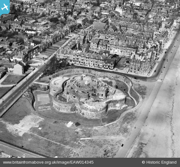
EAW014345 ENGLAND (1948). Deal Castle, Deal, 1948
© Copyright OpenStreetMap contributors and licensed by the OpenStreetMap Foundation. 2024. Cartography is licensed as CC BY-SA.
Nearby Images (17)
EAW014345

EAW014346

EPW035438

EPW000333

EAW014342

EAW014344

EPW019062

EAW014343

EPW035432

EPW009182

EPW000640

EPW035434

EPW000647

EPW042833

EPW019059

EPW000648

EPW039321

Details
| Title | [EAW014345] Deal Castle, Deal, 1948 |
| Reference | EAW014345 |
| Date | 13-April-1948 |
| Link | |
| Place name | DEAL |
| Parish | DEAL |
| District | |
| Country | ENGLAND |
| Easting / Northing | 637767, 152219 |
| Longitude / Latitude | 1.4052752270021, 51.219054664378 |
| National Grid Reference | TR378522 |
Pins
 Alan McFaden |
Wednesday 9th of July 2014 10:01:06 AM |


