
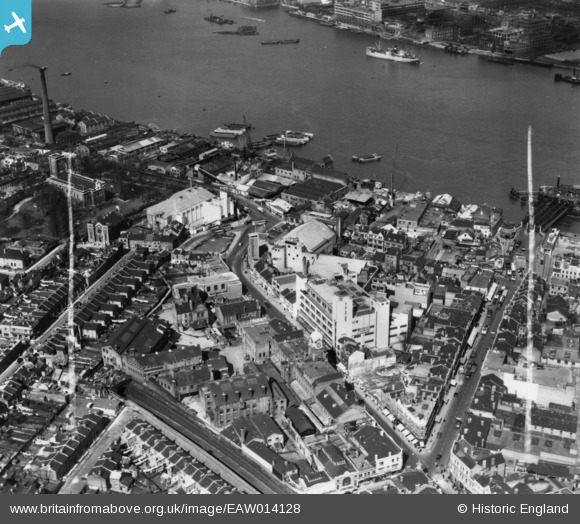
EAW014128 ENGLAND (1948). The Royal Arsenal Co-operative Society Central Premises on Powis Street and environs, Woolwich, 1948. This image has been produced from a print marked by Aerofilms Ltd for photo-editing.
© Copyright OpenStreetMap contributors and licensed by the OpenStreetMap Foundation. 2024. Cartography is licensed as CC BY-SA.
Nearby Images (12)
EAW014128

EAW014129

EAW014130

EPW008557

EAW014131

EAW014127

EAW014126

EAW014125

EAW014132

EAW037697

EAW037700

EAW037695

Details
| Title | [EAW014128] The Royal Arsenal Co-operative Society Central Premises on Powis Street and environs, Woolwich, 1948. This image has been produced from a print marked by Aerofilms Ltd for photo-editing. |
| Reference | EAW014128 |
| Date | 5-April-1948 |
| Link | |
| Place name | WOOLWICH |
| Parish | |
| District | |
| Country | ENGLAND |
| Easting / Northing | 543249, 179148 |
| Longitude / Latitude | 0.063692528435987, 51.49262022458 |
| National Grid Reference | TQ432791 |
Pins
 John W |
Tuesday 3rd of May 2016 08:24:42 PM | |
John W |
Tuesday 3rd of May 2016 08:22:12 PM | |
John W |
Tuesday 3rd of May 2016 08:21:16 PM | |
John W |
Tuesday 3rd of May 2016 08:20:07 PM | |
John W |
Tuesday 3rd of May 2016 08:07:30 PM | |
John Wass |
Sunday 29th of March 2015 08:30:47 PM | |
The turning point at Parson's Hill, in front of the Odeon cinema, used by routes 696 to Dartford via Welling and Bexleyheath, and the 698 to Bexleyheath via Abbey Wood and Erith. They stopped running in 1959. |
John W |
Tuesday 3rd of May 2016 08:17:16 PM |


