
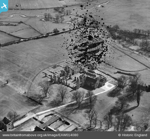
EAW014080 ENGLAND (1948). The remains of the Priory, Castle Acre, 1948. This image has been produced from a damaged negative.
© Copyright OpenStreetMap contributors and licensed by the OpenStreetMap Foundation. 2024. Cartography is licensed as CC BY-SA.
Nearby Images (11)
EAW014080

EAW014086

EPW021281

EPW021280

EAW014082

EAW014084

EAW014083

EPW021297

EPW021298

EAW014085

EAW014081

Details
| Title | [EAW014080] The remains of the Priory, Castle Acre, 1948. This image has been produced from a damaged negative. |
| Reference | EAW014080 |
| Date | 25-March-1948 |
| Link | |
| Place name | CASTLE ACRE |
| Parish | CASTLE ACRE |
| District | |
| Country | ENGLAND |
| Easting / Northing | 581446, 314777 |
| Longitude / Latitude | 0.68563188092551, 52.699870713362 |
| National Grid Reference | TF814148 |
Pins
Be the first to add a comment to this image!


