
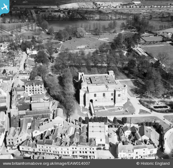
EAW014007 ENGLAND (1948). The Castle and environs, Colchester, 1948
© Copyright OpenStreetMap contributors and licensed by the OpenStreetMap Foundation. 2024. Cartography is licensed as CC BY-SA.
Nearby Images (37)
EAW014007

EAW014004

EAW008095

EAW014009

EAW014005

EAW037253

EAW008091

EAW008092

EAW008093

EAW008094

EAW014006

EAW029734

EAW014003

EAW037254

EAW014008

EAW037491

EAW013999

EPW018558

EAW029729

EPW018549

EAW014002

EPW016543

EPW016543
EPW018550

EAW014010

EAW056122

EPW058740

EAW029730

EAW037495

EAW015360

EAW037499

EAW024677

EPW018546

EPW058742

EAW037497

EPW018559

EAW037258

Details
| Title | [EAW014007] The Castle and environs, Colchester, 1948 |
| Reference | EAW014007 |
| Date | 23-March-1948 |
| Link | |
| Place name | COLCHESTER |
| Parish | |
| District | |
| Country | ENGLAND |
| Easting / Northing | 599848, 225322 |
| Longitude / Latitude | 0.9045618208655, 51.89012914196 |
| National Grid Reference | TL998253 |
Pins
 redmist |
Sunday 28th of January 2024 03:35:09 PM | |
 Matt Aldred edob.mattaldred.com |
Thursday 18th of February 2021 05:01:24 PM | |
Matt Aldred edob.mattaldred.com |
Thursday 18th of February 2021 04:56:34 PM | |
Matt Aldred edob.mattaldred.com |
Thursday 18th of February 2021 04:56:23 PM | |
Matt Aldred edob.mattaldred.com |
Thursday 18th of February 2021 04:54:50 PM |


