
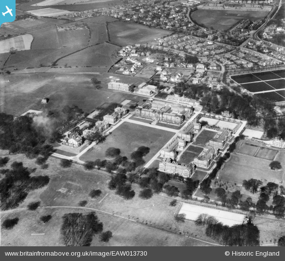
EAW013730 ENGLAND (1948). The City of Leeds Training College, Beckett Park, 1948
© Copyright OpenStreetMap contributors and licensed by the OpenStreetMap Foundation. 2024. Cartography is licensed as CC BY-SA.
Nearby Images (3)
EAW013730

EAW013729

EPW015917

Details
| Title | [EAW013730] The City of Leeds Training College, Beckett Park, 1948 |
| Reference | EAW013730 |
| Date | 11-March-1948 |
| Link | |
| Place name | BECKETT PARK |
| Parish | |
| District | |
| Country | ENGLAND |
| Easting / Northing | 426869, 436822 |
| Longitude / Latitude | -1.5917488876633, 53.826758340699 |
| National Grid Reference | SE269368 |
Pins
 redmist |
Thursday 11th of October 2018 07:47:51 PM |


