
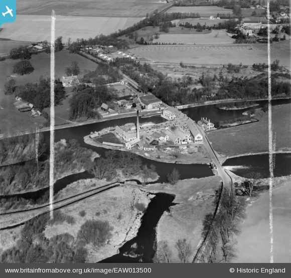
EAW013500 ENGLAND (1948). St Neots Paper Mills, Little Paxton, 1948. This image was marked by Aerofilms Ltd for photo editing.
© Copyright OpenStreetMap contributors and licensed by the OpenStreetMap Foundation. 2024. Cartography is licensed as CC BY-SA.
Nearby Images (16)
EAW013500

EAW013510

EAW013511

EAW013504

EAW013501

EAW013497

EAW013499

EAW013506

EAW013508

EAW013498

EAW013507

EAW013503

EAW003730

EAW013502

EAW013509

EAW013505

Details
| Title | [EAW013500] St Neots Paper Mills, Little Paxton, 1948. This image was marked by Aerofilms Ltd for photo editing. |
| Reference | EAW013500 |
| Date | 9-March-1948 |
| Link | |
| Place name | LITTLE PAXTON |
| Parish | LITTLE PAXTON |
| District | |
| Country | ENGLAND |
| Easting / Northing | 518594, 261858 |
| Longitude / Latitude | -0.26289355844295, 52.241717749446 |
| National Grid Reference | TL186619 |
Pins
 melgibbs |
Saturday 15th of February 2014 06:04:21 PM |


