
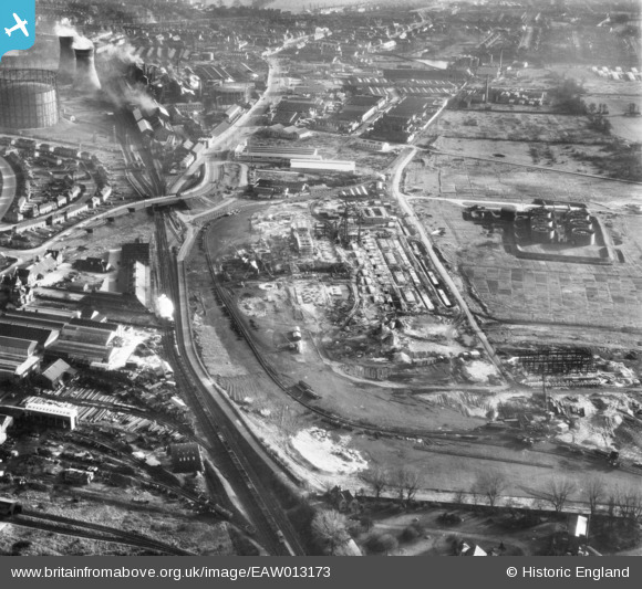
EAW013173 ENGLAND (1948). The Croydon B Power Station under construction, Croydon, 1948
© Copyright OpenStreetMap contributors and licensed by the OpenStreetMap Foundation. 2024. Cartography is licensed as CC BY-SA.
Nearby Images (20)
EAW013173

EAW013176

EAW013171

EAW013172

EAW013174

EAW026598

EAW026596

EAW026600

EAW026597

EAW013178

EAW013175

EAW013182

EAW013177

EAW026588

EAW013183

EAW026590

EAW013180

EAW026595

EAW026589

EAW026591

Details
| Title | [EAW013173] The Croydon B Power Station under construction, Croydon, 1948 |
| Reference | EAW013173 |
| Date | 9-February-1948 |
| Link | |
| Place name | CROYDON |
| Parish | |
| District | |
| Country | ENGLAND |
| Easting / Northing | 530655, 166278 |
| Longitude / Latitude | -0.12238067380102, 51.379999054625 |
| National Grid Reference | TQ307663 |


