
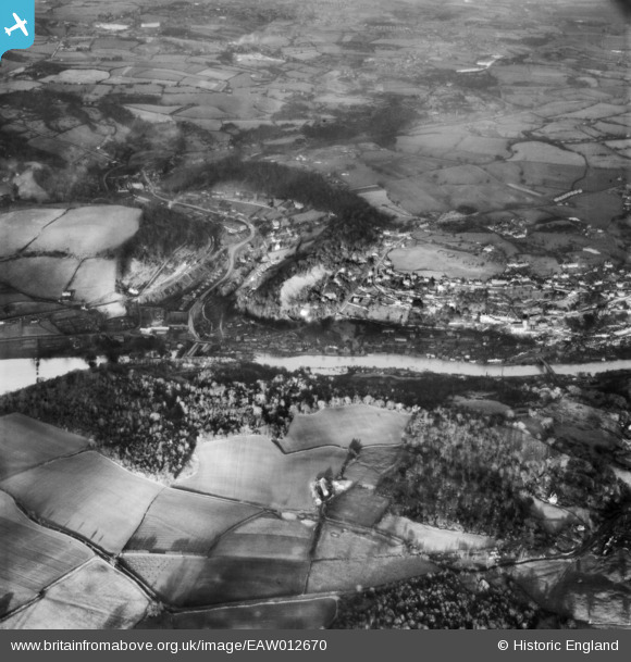
EAW012670 ENGLAND (1948). The River Severn in flood, Coalbrookdale, 1948
© Copyright OpenStreetMap contributors and licensed by the OpenStreetMap Foundation. 2024. Cartography is licensed as CC BY-SA.
Nearby Images (2)
EAW012670

EAW024222

Details
| Title | [EAW012670] The River Severn in flood, Coalbrookdale, 1948 |
| Reference | EAW012670 |
| Date | 14-January-1948 |
| Link | |
| Place name | COALBROOKDALE |
| Parish | THE GORGE |
| District | |
| Country | ENGLAND |
| Easting / Northing | 366900, 303728 |
| Longitude / Latitude | -2.489094927283, 52.629945537605 |
| National Grid Reference | SJ669037 |
Pins
Be the first to add a comment to this image!


