
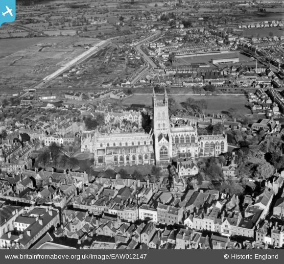
EAW012147 ENGLAND (1947). Gloucester Cathedral, Gloucester, 1947
© Copyright OpenStreetMap contributors and licensed by the OpenStreetMap Foundation. 2024. Cartography is licensed as CC BY-SA.
Nearby Images (24)
EAW012147

EAW000731

EPW024170

EAW032305

EAW032303

EPW041487

EAW032306

EAW003568

EAW003569

EAW003567

EAW032304

EPW006011

EPW024158

EPW024152

EPW024155

EAW000730

EAW003565

EPW024163

EAW003566

EPW024165

EAW000727

EAW000729

EAW000726

EAW018729

Details
| Title | [EAW012147] Gloucester Cathedral, Gloucester, 1947 |
| Reference | EAW012147 |
| Date | 5-November-1947 |
| Link | |
| Place name | GLOUCESTER |
| Parish | |
| District | |
| Country | ENGLAND |
| Easting / Northing | 383130, 218882 |
| Longitude / Latitude | -2.2450400372799, 51.867818965126 |
| National Grid Reference | SO831189 |
Pins
Be the first to add a comment to this image!


