
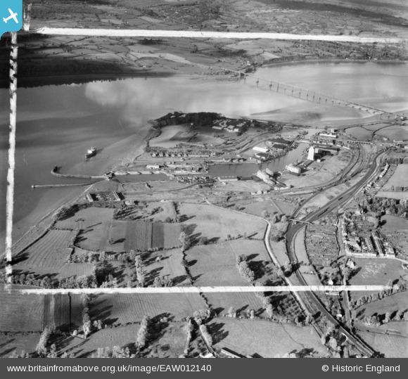
EAW012140 ENGLAND (1947). Sharpness Docks, Sharpness, 1947. This image was marked by Aerofilms Ltd for photo editing.
© Copyright OpenStreetMap contributors and licensed by the OpenStreetMap Foundation. 2024. Cartography is licensed as CC BY-SA.
Nearby Images (10)
EAW012140

EPW005401

EPW029343

EPW037753

EPW029349

EPW029346

EPW029344

EAW012138

EAW012141

EPW029345

Details
| Title | [EAW012140] Sharpness Docks, Sharpness, 1947. This image was marked by Aerofilms Ltd for photo editing. |
| Reference | EAW012140 |
| Date | 5-November-1947 |
| Link | |
| Place name | SHARPNESS |
| Parish | HINTON |
| District | |
| Country | ENGLAND |
| Easting / Northing | 367020, 202234 |
| Longitude / Latitude | -2.4774509092713, 51.717404409774 |
| National Grid Reference | SO670022 |
Pins
 Louis |
Wednesday 12th of November 2014 08:40:44 PM |


