
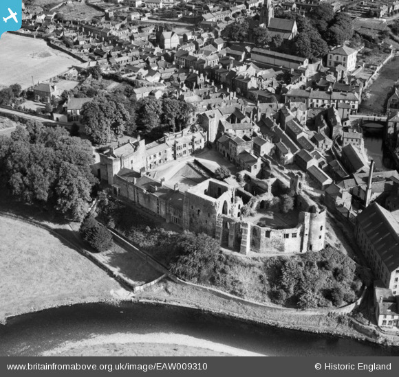
EAW009310 ENGLAND (1947). Cockermouth Castle, Cockermouth, 1947
© Copyright OpenStreetMap contributors and licensed by the OpenStreetMap Foundation. 2024. Cartography is licensed as CC BY-SA.
Nearby Images (12)
EAW009310

EAW009308

EAW009307

EAW009309

EAW009312

EAW009306
, Cockermouth, 1947")
EAW009311

EPW029254

EPW029260

EPW029250

EPW029256

EPW029257

Details
| Title | [EAW009310] Cockermouth Castle, Cockermouth, 1947 |
| Reference | EAW009310 |
| Date | 11-August-1947 |
| Link | |
| Place name | COCKERMOUTH |
| Parish | COCKERMOUTH |
| District | |
| Country | ENGLAND |
| Easting / Northing | 312243, 530862 |
| Longitude / Latitude | -3.3607416689719, 54.665074811625 |
| National Grid Reference | NY122309 |
Pins
Be the first to add a comment to this image!


