
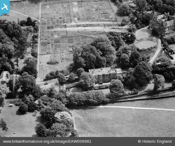
EAW006961 ENGLAND (1947). The house of Sir John Archer alongside Terrace Field, Richmond Hill, 1947
© Copyright OpenStreetMap contributors and licensed by the OpenStreetMap Foundation. 2024. Cartography is licensed as CC BY-SA.
Nearby Images (18)
EAW006961

EAW006960

EAW006958

EAW006953

EAW006959

EAW006957

EAW006956

EAW006951

EAW006954

EAW006955

EAW006952

EAW008243

EPW001697

EAW006963

EAW006964

EPW001699

EPR000652

EPW035019

Details
| Title | [EAW006961] The house of Sir John Archer alongside Terrace Field, Richmond Hill, 1947 |
| Reference | EAW006961 |
| Date | 16-June-1947 |
| Link | |
| Place name | RICHMOND HILL |
| Parish | |
| District | |
| Country | ENGLAND |
| Easting / Northing | 518156, 173885 |
| Longitude / Latitude | -0.29937620128279, 51.451115792896 |
| National Grid Reference | TQ182739 |
Pins
Be the first to add a comment to this image!


