
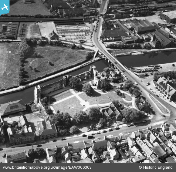
EAW006303 ENGLAND (1947). Newark Castle, Newark-on-Trent, 1947. This image has been produced from a print.
© Copyright OpenStreetMap contributors and licensed by the OpenStreetMap Foundation. 2024. Cartography is licensed as CC BY-SA.
Nearby Images (18)
EAW006303

EAW006304

EPW013025

EAW006307

EAW016512

EPW015267

EPW015268

EAW016508

EAW016511

EAW006308

EAW013672

EAW006306

EAW013673

EPW016193

EAW016510

EAW006301

EAW016509

EAW013675

Details
| Title | [EAW006303] Newark Castle, Newark-on-Trent, 1947. This image has been produced from a print. |
| Reference | EAW006303 |
| Date | 27-May-1947 |
| Link | |
| Place name | NEWARK-ON-TRENT |
| Parish | NEWARK |
| District | |
| Country | ENGLAND |
| Easting / Northing | 479642, 354063 |
| Longitude / Latitude | -0.810998935715, 53.077548950832 |
| National Grid Reference | SK796541 |
Pins
Be the first to add a comment to this image!


