
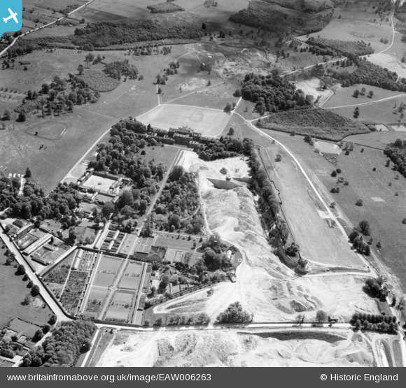
EAW006263 ENGLAND (1947). Quarrying around Wentworth Woodhouse Gardens, Wentworth, 1947
© Copyright OpenStreetMap contributors and licensed by the OpenStreetMap Foundation. 2024. Cartography is licensed as CC BY-SA.
Nearby Images (8)
EAW006263

EAW005598

EAW006262

EAW005599

EAW005600

EAW003478

EAW006264

EPW015433

Details
| Title | [EAW006263] Quarrying around Wentworth Woodhouse Gardens, Wentworth, 1947 |
| Reference | EAW006263 |
| Date | 25-May-1947 |
| Link | |
| Place name | WENTWORTH |
| Parish | WENTWORTH |
| District | |
| Country | ENGLAND |
| Easting / Northing | 439373, 397675 |
| Longitude / Latitude | -1.4067313136755, 53.474078867147 |
| National Grid Reference | SK394977 |
Pins
 redmist |
Wednesday 10th of July 2019 10:05:04 AM | |
redmist |
Wednesday 10th of July 2019 10:02:58 AM |


