
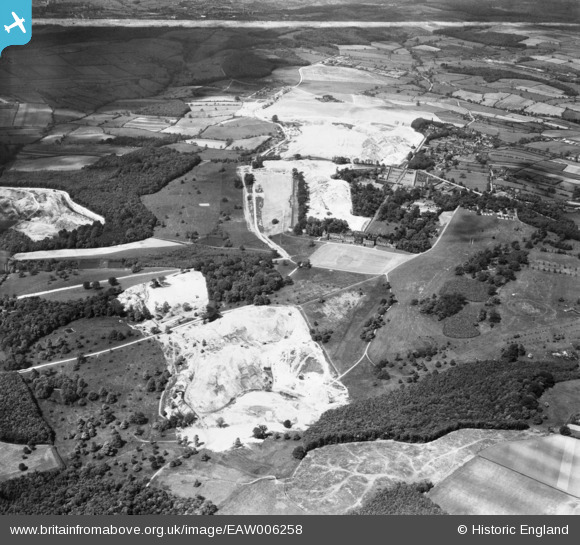
EAW006258 ENGLAND (1947). Wentworth Woodhouse and quarrying in Wentworth Park, Wentworth, 1947. This image was marked by Aerofilms Ltd for photo editing.
© Copyright OpenStreetMap contributors and licensed by the OpenStreetMap Foundation. 2024. Cartography is licensed as CC BY-SA.
Nearby Images (7)
EAW006258

EAW006261

EAW005604

EAW005601

EAW005603

EAW005602

EPW015433

Details
| Title | [EAW006258] Wentworth Woodhouse and quarrying in Wentworth Park, Wentworth, 1947. This image was marked by Aerofilms Ltd for photo editing. |
| Reference | EAW006258 |
| Date | 25-May-1947 |
| Link | |
| Place name | WENTWORTH |
| Parish | WENTWORTH |
| District | |
| Country | ENGLAND |
| Easting / Northing | 439709, 397484 |
| Longitude / Latitude | -1.4016929481766, 53.472336726608 |
| National Grid Reference | SK397975 |
Pins
Be the first to add a comment to this image!


