
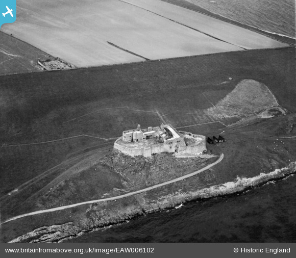
EAW006102 ENGLAND (1947). Lindisfarne Castle, Holy Island, 1947
© Copyright OpenStreetMap contributors and licensed by the OpenStreetMap Foundation. 2024. Cartography is licensed as CC BY-SA.
Nearby Images (19)
EAW006102

EAW006098

EAW006099

EAW006100

EAW008899

EPW040696

EAW008900

EAW008896

EAW008897

EAW008050

EAW008898

EAW019696

EAW019694

EAW019697

EAW006101

EAW034341

EAW019695

EAW034340

EPW040695

Details
| Title | [EAW006102] Lindisfarne Castle, Holy Island, 1947 |
| Reference | EAW006102 |
| Date | 21-May-1947 |
| Link | |
| Place name | HOLY ISLAND |
| Parish | HOLY ISLAND |
| District | |
| Country | ENGLAND |
| Easting / Northing | 413666, 641800 |
| Longitude / Latitude | -1.7827097128673, 55.669519852705 |
| National Grid Reference | NU137418 |


