
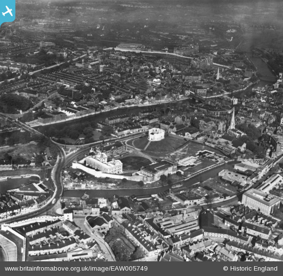
EAW005749 ENGLAND (1947). Clifford's Tower and the site of York Castle, York, 1947. This image has been produced from a print.
© Copyright OpenStreetMap contributors and licensed by the OpenStreetMap Foundation. 2024. Cartography is licensed as CC BY-SA.
Nearby Images (12)
EAW005749

EAW005744

EAW005745

EAW005748

EAW005747

EPW016071

EAW049618

EAW005746

EAW049630

EAW049693

EAW049631

EAW049633

Details
| Title | [EAW005749] Clifford's Tower and the site of York Castle, York, 1947. This image has been produced from a print. |
| Reference | EAW005749 |
| Date | 15-May-1947 |
| Link | |
| Place name | YORK |
| Parish | |
| District | |
| Country | ENGLAND |
| Easting / Northing | 460401, 451465 |
| Longitude / Latitude | -1.0794236455748, 53.955550175929 |
| National Grid Reference | SE604515 |
Pins
User Comment Contributions
 Clifford's Tower, York, 28/08/2014 |
 Class31 |
Wednesday 19th of November 2014 11:15:48 AM |


