
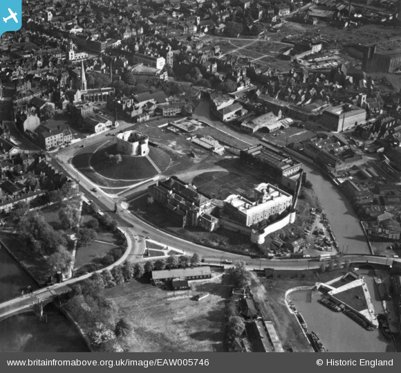
EAW005746 ENGLAND (1947). Clifford's Tower and the site of York Castle, York, 1947. This image has been produced from a print.
© Copyright OpenStreetMap contributors and licensed by the OpenStreetMap Foundation. 2024. Cartography is licensed as CC BY-SA.
Nearby Images (14)
EAW005746

EAW005748

EPW016071

EAW049618

EAW005744

EAW005747

EAW005745

EAW005749

EAW049630

EAW049629

EAW049634

EAW049632

EAW049693

EAW049635

Details
| Title | [EAW005746] Clifford's Tower and the site of York Castle, York, 1947. This image has been produced from a print. |
| Reference | EAW005746 |
| Date | 15-May-1947 |
| Link | |
| Place name | YORK |
| Parish | |
| District | |
| Country | ENGLAND |
| Easting / Northing | 460523, 451445 |
| Longitude / Latitude | -1.0775684673425, 53.955356163374 |
| National Grid Reference | SE605514 |


