
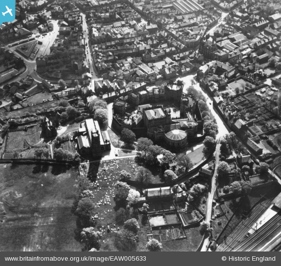
EAW005633 ENGLAND (1947). Lancaster Castle and St Mary's Church, Lancaster, 1947. This image has been produced from a print.
© Copyright OpenStreetMap contributors and licensed by the OpenStreetMap Foundation. 2024. Cartography is licensed as CC BY-SA.
Nearby Images (15)
EAW005633

EAW005632

EAW005630

EPW029178

EPW042028

EAW003570

EPW042027

EAW037592

EAW005629

EAW023385

EPW026404

EAW005631

EPW002092

EAW023386

EPW002086

Details
| Title | [EAW005633] Lancaster Castle and St Mary's Church, Lancaster, 1947. This image has been produced from a print. |
| Reference | EAW005633 |
| Date | 15-May-1947 |
| Link | |
| Place name | LANCASTER |
| Parish | |
| District | |
| Country | ENGLAND |
| Easting / Northing | 347358, 461878 |
| Longitude / Latitude | -2.8041365948396, 54.049988199124 |
| National Grid Reference | SD474619 |
Pins
Be the first to add a comment to this image!


