
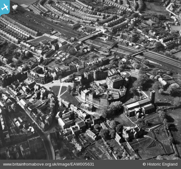
EAW005631 ENGLAND (1947). Lancaster Castle and St Mary's Church, Lancaster, 1947. This image has been produced from a print.
© Copyright OpenStreetMap contributors and licensed by the OpenStreetMap Foundation. 2024. Cartography is licensed as CC BY-SA.
Nearby Images (15)
EAW005631

EAW023386

EAW005629

EPW042027

EAW003570

EPW026404

EAW037592

EPW029178

EAW005630

EPW042028

EAW005632

EAW005633

EPW002092

EAW023385

EPW002086

Details
| Title | [EAW005631] Lancaster Castle and St Mary's Church, Lancaster, 1947. This image has been produced from a print. |
| Reference | EAW005631 |
| Date | 15-May-1947 |
| Link | |
| Place name | LANCASTER |
| Parish | |
| District | |
| Country | ENGLAND |
| Easting / Northing | 347368, 461814 |
| Longitude / Latitude | -2.8039727509927, 54.049414004268 |
| National Grid Reference | SD474618 |
Pins
 Will |
Friday 14th of August 2015 03:23:14 AM | |
Will |
Friday 14th of August 2015 03:21:33 AM | |
This is actually the Eastern entrance nearest the city centre and for a number of years became the only passenger entrance to the station from the mid 1960s. |
Dirk41 |
Thursday 17th of December 2015 10:42:31 PM |
Will |
Friday 14th of August 2015 03:18:48 AM | |
Will |
Friday 14th of August 2015 03:16:30 AM |


