
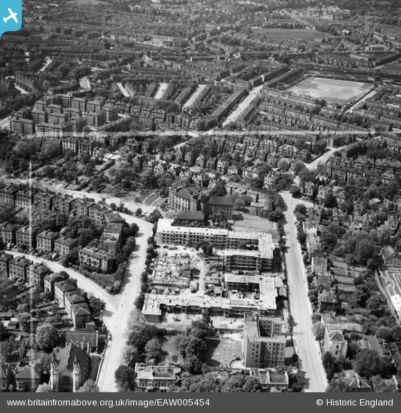
EAW005454 ENGLAND (1947). The Hilldrop Estate under construction, Tufnell Park, 1947. This image was marked by Aerofilms Ltd for photo editing.
© Copyright OpenStreetMap contributors and licensed by the OpenStreetMap Foundation. 2024. Cartography is licensed as CC BY-SA.
Nearby Images (14)
EAW005454

EAW005449

EAW005448

EPW053671

EAW005453

EAW005457

EAW005452

EAW005447

EAW005451

EPW053673
 and environs, Tufnell Park, 1937. This image has been affected by flare.")
EAW005466

EPW053670

EAW005455

EAW005459

Details
| Title | [EAW005454] The Hilldrop Estate under construction, Tufnell Park, 1947. This image was marked by Aerofilms Ltd for photo editing. |
| Reference | EAW005454 |
| Date | May-1947 |
| Link | |
| Place name | TUFNELL PARK |
| Parish | |
| District | |
| Country | ENGLAND |
| Easting / Northing | 529842, 185489 |
| Longitude / Latitude | -0.12699923065151, 51.552849628721 |
| National Grid Reference | TQ298855 |
Pins
 mike18 |
Wednesday 25th of February 2015 02:24:37 PM | |
jar |
Wednesday 22nd of October 2014 09:30:52 PM | |
jar |
Wednesday 22nd of October 2014 09:30:17 PM | |
jar |
Wednesday 22nd of October 2014 09:29:24 PM | |
jar |
Wednesday 22nd of October 2014 09:28:46 PM | |
mike18 |
Saturday 18th of January 2014 06:12:27 PM |


