
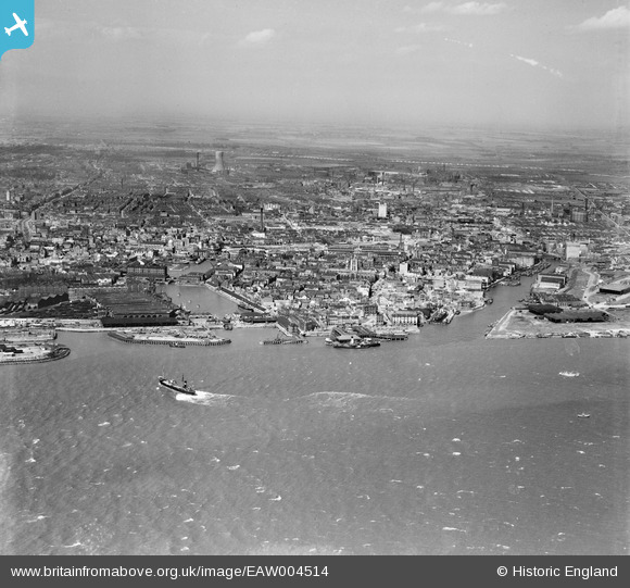
EAW004514 ENGLAND (1947). The city, Kingston upon Hull, from the south-east, 1947
© Copyright OpenStreetMap contributors and licensed by the OpenStreetMap Foundation. 2024. Cartography is licensed as CC BY-SA.
Nearby Images (8)
EAW004514

EPW036412

EPW036414

EPW036560

EPW036413

EAW046145

EPW036375

EAW046146

Details
| Title | [EAW004514] The city, Kingston upon Hull, from the south-east, 1947 |
| Reference | EAW004514 |
| Date | 16-April-1947 |
| Link | |
| Place name | KINGSTON UPON HULL |
| Parish | |
| District | |
| Country | ENGLAND |
| Easting / Northing | 510001, 427977 |
| Longitude / Latitude | -0.3321531896734, 53.73633940384 |
| National Grid Reference | TA100280 |
Pins
 Chris Kolonko |
Tuesday 7th of May 2019 02:52:53 PM | |
Chris Kolonko |
Tuesday 7th of May 2019 02:52:11 PM | |
Chris Kolonko |
Wednesday 24th of April 2019 03:55:51 PM | |
redmist |
Thursday 1st of November 2018 10:35:03 AM | |
Val |
Sunday 15th of January 2017 01:16:50 PM | |
Val |
Sunday 15th of January 2017 01:16:06 PM | |
Val |
Sunday 15th of January 2017 01:15:38 PM | |
John Wass |
Wednesday 1st of October 2014 03:53:46 PM | |
John Wass |
Saturday 21st of June 2014 04:57:45 PM | |
 David Jessop |
Thursday 20th of February 2014 10:31:58 PM |


