
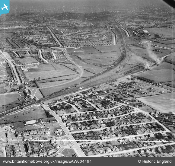
EAW004494 ENGLAND (1947). Northolt Junction, Victoria Road and environs, South Ruislip, from the west, 1947
© Copyright OpenStreetMap contributors and licensed by the OpenStreetMap Foundation. 2024. Cartography is licensed as CC BY-SA.
Details
| Title | [EAW004494] Northolt Junction, Victoria Road and environs, South Ruislip, from the west, 1947 |
| Reference | EAW004494 |
| Date | 14-April-1947 |
| Link | |
| Place name | SOUTH RUISLIP |
| Parish | |
| District | |
| Country | ENGLAND |
| Easting / Northing | 511108, 185224 |
| Longitude / Latitude | -0.39720184483416, 51.554469126978 |
| National Grid Reference | TQ111852 |
Pins
 Matt Aldred edob.mattaldred.com |
Friday 29th of March 2024 06:20:24 PM | |
 chris w |
Tuesday 1st of February 2022 10:47:10 PM | |
Leslie B |
Sunday 3rd of September 2017 04:49:05 PM | |
Leslie B |
Thursday 3rd of March 2016 07:58:07 PM | |
The Laird |
Thursday 3rd of March 2016 06:22:50 PM | |
John Wass |
Friday 14th of August 2015 04:11:03 PM | |
Paul |
Wednesday 21st of May 2014 06:56:25 AM | |
southallboy |
Tuesday 17th of September 2013 05:59:25 PM | |
southallboy |
Tuesday 17th of September 2013 05:57:59 PM | |
Paul |
Monday 26th of August 2013 08:25:27 PM |


