
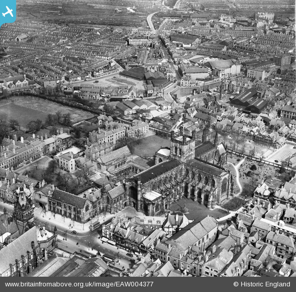
EAW004377 ENGLAND (1947). The Cathedral Church of Christ and the Blessed Virgin Mary and environs, Chester, 1947
© Copyright OpenStreetMap contributors and licensed by the OpenStreetMap Foundation. 2024. Cartography is licensed as CC BY-SA.
Nearby Images (21)
EAW004377

EPW058007

EPW004007

EPW011199

EPW004006

EPW040162

EPW029880

EPW005885

EPW029886

EPW004003

EPW004008

EPW029883

EPW040167

EPW029885

EPW058002

EPW029881

EPW036913

EPW003097

EPW058010

EPW058011

EPW003090

Details
| Title | [EAW004377] The Cathedral Church of Christ and the Blessed Virgin Mary and environs, Chester, 1947 |
| Reference | EAW004377 |
| Date | 13-April-1947 |
| Link | |
| Place name | CHESTER |
| Parish | |
| District | |
| Country | ENGLAND |
| Easting / Northing | 340639, 366536 |
| Longitude / Latitude | -2.8885763651898, 53.192307577319 |
| National Grid Reference | SJ406665 |
Pins
 Rachel |
Monday 20th of February 2023 01:27:12 PM | |
Rachel |
Monday 20th of February 2023 01:26:33 PM | |
 Matt Aldred edob.mattaldred.com |
Sunday 6th of February 2022 08:18:20 PM | |
Matt Aldred edob.mattaldred.com |
Sunday 6th of February 2022 08:18:12 PM |


