
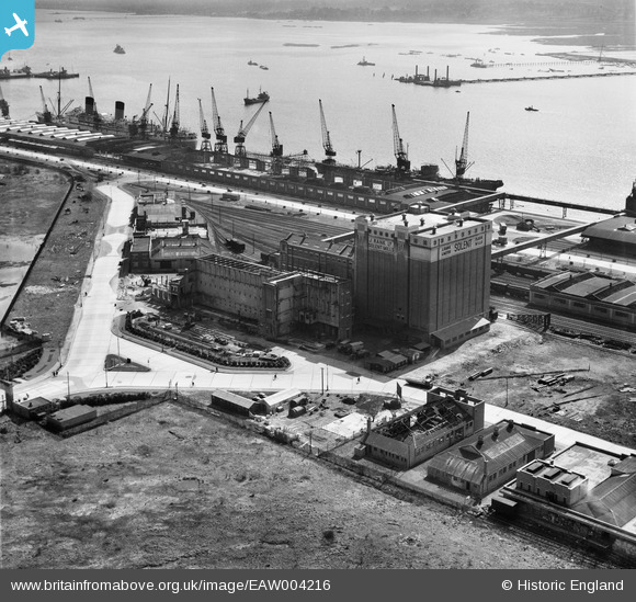
EAW004216 ENGLAND (1947). J. Rank Ltd Solent Flour Mills, Southampton, 1947
© Copyright OpenStreetMap contributors and licensed by the OpenStreetMap Foundation. 2024. Cartography is licensed as CC BY-SA.
Nearby Images (34)
EAW004216

EAW004218

EAW004221

EAW004220

EAW020018

EAW004214

EAW020021

EAW035616

EPW032349
 under construction, Southampton, from the west, 1930. This image has been produced from a copy-negative.")
EAW004213

EAW004215

EAW035624

EAW004219

EAW020014

EAW035622

EAW004212

EAW035625

EAW035619

EAW035615

EAW035623

EAW020012

EAW035621

EAW004217

EAW020020

EAW020019

EAW020015

EAW020016

EAW035618

EAW035620

EAW020013

EAW035617

EAW001344
, Southampton, from the south, 1946")
EAW001338
, Southampton, 1946")
EAW022292
, Southampton, 1949")
Details
| Title | [EAW004216] J. Rank Ltd Solent Flour Mills, Southampton, 1947 |
| Reference | EAW004216 |
| Date | 10-April-1947 |
| Link | |
| Place name | SOUTHAMPTON |
| Parish | |
| District | |
| Country | ENGLAND |
| Easting / Northing | 440996, 111731 |
| Longitude / Latitude | -1.4169147037708, 50.90304322358 |
| National Grid Reference | SU410117 |
Pins
Be the first to add a comment to this image!


