
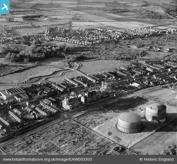
EAW003300 ENGLAND (1946). The Lincoln Gas Works and environs, Bracebridge, 1946
© Copyright OpenStreetMap contributors and licensed by the OpenStreetMap Foundation. 2024. Cartography is licensed as CC BY-SA.
Nearby Images (21)
EAW003300

EPW041501

EPW041498

EAW003310

EAW002776

EPW041499

EPW041500

EAW003307

EAW002775

EAW003306

EPW041497

EAW003304

EAW003308

EAW003301

EAW003305

EAW003309

EAW003302

EPW041496

EAW002778

EAW003303

EAW002780

Details
| Title | [EAW003300] The Lincoln Gas Works and environs, Bracebridge, 1946 |
| Reference | EAW003300 |
| Date | 4-November-1946 |
| Link | |
| Place name | BRACEBRIDGE |
| Parish | |
| District | |
| Country | ENGLAND |
| Easting / Northing | 496862, 368884 |
| Longitude / Latitude | -0.5495165361028, 53.207901607067 |
| National Grid Reference | SK969689 |
Pins
 Les Carter |
Friday 30th of September 2022 12:35:35 PM | |
Les Carter |
Friday 30th of September 2022 12:33:30 PM | |
Les Carter |
Friday 30th of September 2022 12:30:10 PM | |
Les Carter |
Friday 18th of December 2020 03:43:42 PM | |
Sparky |
Tuesday 8th of August 2017 08:58:17 AM | |
Sparky |
Wednesday 2nd of August 2017 09:29:26 PM | |
Sparky |
Wednesday 2nd of August 2017 09:28:56 PM |


