
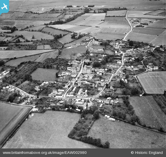
EAW002980 ENGLAND (1946). The village, Middlezoy, 1946
© Copyright OpenStreetMap contributors and licensed by the OpenStreetMap Foundation. 2024. Cartography is licensed as CC BY-SA.
Details
| Title | [EAW002980] The village, Middlezoy, 1946 |
| Reference | EAW002980 |
| Date | 3-October-1946 |
| Link | |
| Place name | MIDDLEZOY |
| Parish | MIDDLEZOY |
| District | |
| Country | ENGLAND |
| Easting / Northing | 337533, 132816 |
| Longitude / Latitude | -2.8920624892723, 51.09071934953 |
| National Grid Reference | ST375328 |
Pins
 cptpies |
Wednesday 15th of January 2014 04:06:52 PM | |
topsy |
Tuesday 27th of August 2013 08:47:53 PM | |
topsy |
Tuesday 27th of August 2013 08:41:19 PM | |
The airfield at Weston Zoyland had a long history of occupation by the RAF before and after the USAAF, who were in residence for a short period from May to June 1944. RAF Mosquitoes can be seen in this image, |
Graham Yaxley |
Tuesday 30th of December 2014 06:49:33 PM |
User Comment Contributions
 Stanton shelters at Weston Zoyland dispersed site. |
cptpies |
Wednesday 15th of January 2014 04:07:31 PM |


