
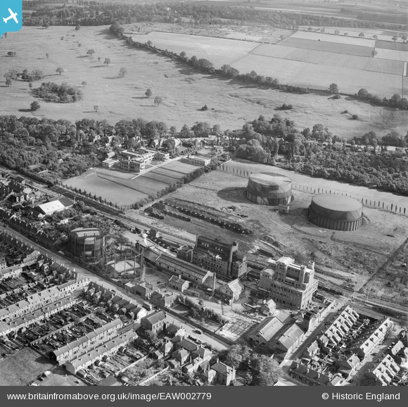
EAW002779 ENGLAND (1946). The Gas Works and South Common, Bracebridge, 1946
© Copyright OpenStreetMap contributors and licensed by the OpenStreetMap Foundation. 2024. Cartography is licensed as CC BY-SA.
Nearby Images (24)
EAW002779

EAW003304

EAW002775

EPW041495

EAW003301

EAW003305

EAW003302

EAW002776

EAW002778

EAW003303

EPW041498

EPW041499

EPW041500

EPW041501

EPW041496

EPW041497

EAW003306

EAW002780

EAW003310

EAW003307

EAW003308

EAW003309

EAW002777

EAW003311

Details
| Title | [EAW002779] The Gas Works and South Common, Bracebridge, 1946 |
| Reference | EAW002779 |
| Date | 11-September-1946 |
| Link | |
| Place name | BRACEBRIDGE |
| Parish | |
| District | |
| Country | ENGLAND |
| Easting / Northing | 497134, 368809 |
| Longitude / Latitude | -0.54546767033255, 53.207177944447 |
| National Grid Reference | SK971688 |


