
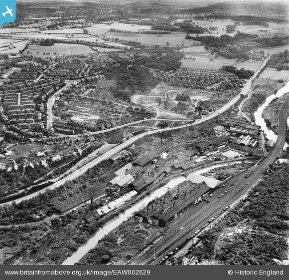
EAW002629 ENGLAND (1946). The Kirkstall Iron and Steel Forge and the surrounding area, Bramley Fall, 1946
© Copyright OpenStreetMap contributors and licensed by the OpenStreetMap Foundation. 2024. Cartography is licensed as CC BY-SA.
Nearby Images (13)
EAW002629

EAW002623

EAW002622

EPW039023

EAW002627

EPW039020

EPW039022

EPW039019

EPW039021

EAW002621

EAW002628

EAW002625

EAW002624

Details
| Title | [EAW002629] The Kirkstall Iron and Steel Forge and the surrounding area, Bramley Fall, 1946 |
| Reference | EAW002629 |
| Date | 19-September-1946 |
| Link | |
| Place name | BRAMLEY FALL |
| Parish | |
| District | |
| Country | ENGLAND |
| Easting / Northing | 424992, 436712 |
| Longitude / Latitude | -1.6202764975443, 53.825863231797 |
| National Grid Reference | SE250367 |
Pins
 redmist |
Wednesday 10th of November 2021 10:44:02 PM | |
redmist |
Wednesday 10th of November 2021 02:13:52 PM | |
redmist |
Wednesday 10th of November 2021 02:12:39 PM | |
redmist |
Wednesday 10th of November 2021 02:10:07 PM | |
redmist |
Friday 31st of July 2020 09:24:37 PM | |
Sparky |
Saturday 16th of September 2017 09:59:23 PM | |
 Class31 |
Friday 28th of August 2015 03:49:10 PM | |
steve |
Wednesday 8th of April 2015 10:32:50 AM |


