
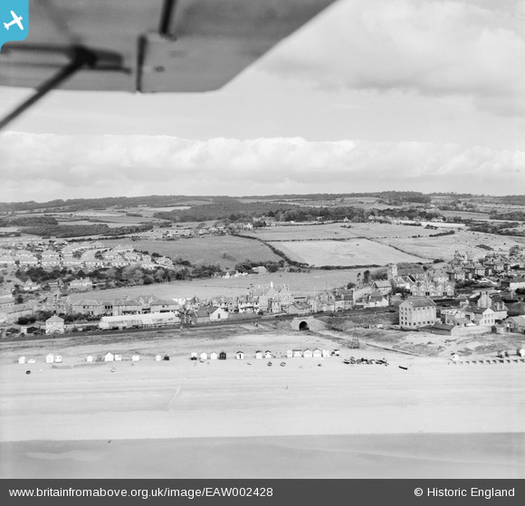
EAW002428 ENGLAND (1946). Beach huts adjacent to the railway line, West Marina, from the south, 1946
© Copyright OpenStreetMap contributors and licensed by the OpenStreetMap Foundation. 2024. Cartography is licensed as CC BY-SA.
Nearby Images (3)
EAW002428

EAW002427

EPW035343

Details
| Title | [EAW002428] Beach huts adjacent to the railway line, West Marina, from the south, 1946 |
| Reference | EAW002428 |
| Date | 16-September-1946 |
| Link | |
| Place name | WEST MARINA |
| Parish | |
| District | |
| Country | ENGLAND |
| Easting / Northing | 578318, 108743 |
| Longitude / Latitude | 0.53350048909201, 50.8501225696 |
| National Grid Reference | TQ783087 |
Pins
 Sparky |
Sunday 17th of September 2017 03:59:31 PM | |
Sparky |
Saturday 12th of August 2017 11:25:48 PM | |
SonofRuislip |
Saturday 26th of November 2016 07:11:51 PM | |
leigh kennedy |
Tuesday 21st of June 2016 03:54:00 AM | |
cptpies |
Thursday 28th of November 2013 09:52:57 AM |

User Comment Contributions
 Anti Tank Blocks. |
cptpies |
Thursday 19th of December 2013 03:15:21 PM |


