
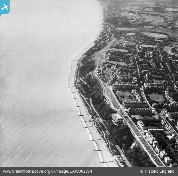
EAW002374 ENGLAND (1946). Clifton Crescent and The Leas, Folkestone, 1946
© Copyright OpenStreetMap contributors and licensed by the OpenStreetMap Foundation. 2024. Cartography is licensed as CC BY-SA.
Nearby Images (17)
EAW002374

EAW002375

EPW009201

EAW024833

EPW000082

EPW000592

EAW024828

EPW000583

EPW000085

EAW002854

EAW024829

EPW000364

EAW024830

EPW009197

EPW035414

EPW000366

EAW002855

Details
| Title | [EAW002374] Clifton Crescent and The Leas, Folkestone, 1946 |
| Reference | EAW002374 |
| Date | 9-September-1946 |
| Link | |
| Place name | FOLKESTONE |
| Parish | FOLKESTONE |
| District | |
| Country | ENGLAND |
| Easting / Northing | 622102, 135366 |
| Longitude / Latitude | 1.1709087581987, 51.07403693348 |
| National Grid Reference | TR221354 |
Pins

User Comment Contributions
 MillPoint Emergency Coast Artillery Battery. |
 cptpies |
Thursday 19th of December 2013 02:37:37 PM |


