
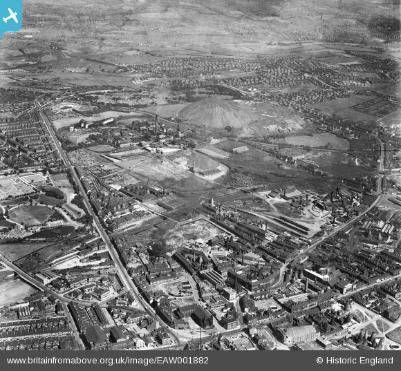
EAW001882 ENGLAND (1946). The Sneyd Colliery and Brick Works and the surrounding area, Burslem, 1946
© Copyright OpenStreetMap contributors and licensed by the OpenStreetMap Foundation. 2024. Cartography is licensed as CC BY-SA.
Nearby Images (21)
EAW001882

EPW034084

EAW001878

EAW001885

EAW001883

EAW001877

EAW001884

EAW001879

EPW034089

EAW001881

EPW034086

EAW001876

EPW034094

EPW034091

EAW038491

EAW038486

EPW034087

EAW038487

EAW038485

EAW038488

EPW034085

Details
| Title | [EAW001882] The Sneyd Colliery and Brick Works and the surrounding area, Burslem, 1946 |
| Reference | EAW001882 |
| Date | 12-July-1946 |
| Link | |
| Place name | BURSLEM |
| Parish | |
| District | |
| Country | ENGLAND |
| Easting / Northing | 387575, 349750 |
| Longitude / Latitude | -2.1853516173908, 53.044569735996 |
| National Grid Reference | SJ876498 |
Pins
 IvanSherratt |
Friday 13th of September 2013 11:38:27 PM | |
IvanSherratt |
Friday 13th of September 2013 11:24:24 PM | |
IvanSherratt |
Friday 13th of September 2013 11:21:27 PM | |
IvanSherratt |
Friday 13th of September 2013 11:20:55 PM |


