
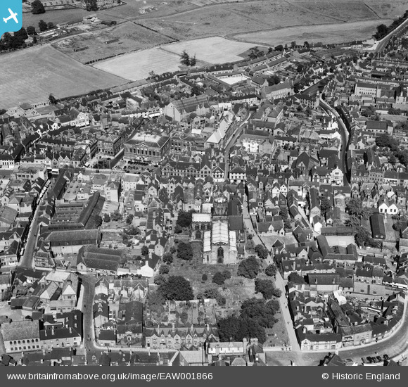
EAW001866 ENGLAND (1946). St Mary's Church and the town centre, Stafford, 1946
© Copyright OpenStreetMap contributors and licensed by the OpenStreetMap Foundation. 2024. Cartography is licensed as CC BY-SA.
Nearby Images (18)
EAW001866

EAW024958

EAW001865

EPW014109

EPW014106

EAW024955

EPW053381

EPW053375

EAW024954

EPW053380

EPW034022

EPW014113

EAW001867

EPW020050

EAW046078

EAW024957

EPW017027

EAW024968

Details
| Title | [EAW001866] St Mary's Church and the town centre, Stafford, 1946 |
| Reference | EAW001866 |
| Date | 12-July-1946 |
| Link | |
| Place name | STAFFORD |
| Parish | |
| District | |
| Country | ENGLAND |
| Easting / Northing | 392182, 323232 |
| Longitude / Latitude | -2.1159873467684, 52.806251860756 |
| National Grid Reference | SJ922232 |
Pins
Be the first to add a comment to this image!


