
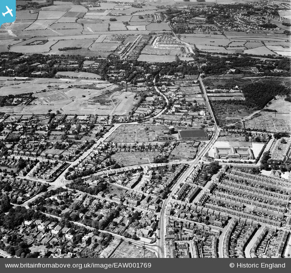
EAW001769 ENGLAND (1946). Upton Road, Birkenhead Corporation Water Works, the Wirral Ladies' Golf Course and environs, Claughton, 1946
© Copyright OpenStreetMap contributors and licensed by the OpenStreetMap Foundation. 2024. Cartography is licensed as CC BY-SA.
Details
| Title | [EAW001769] Upton Road, Birkenhead Corporation Water Works, the Wirral Ladies' Golf Course and environs, Claughton, 1946 |
| Reference | EAW001769 |
| Date | 11-July-1946 |
| Link | |
| Place name | CLAUGHTON |
| Parish | |
| District | |
| Country | ENGLAND |
| Easting / Northing | 329448, 388906 |
| Longitude / Latitude | -3.0610368844546, 53.392007643914 |
| National Grid Reference | SJ294889 |
Pins
 XMAS DAY |
Friday 26th of April 2024 06:26:30 PM | |
XMAS DAY |
Friday 26th of April 2024 06:23:14 PM | |
XMAS DAY |
Friday 26th of April 2024 06:14:36 PM | |
XMAS DAY |
Friday 26th of April 2024 06:11:41 PM | |
XMAS DAY |
Friday 26th of April 2024 06:06:53 PM | |
optikc |
Wednesday 1st of July 2020 04:11:41 PM | |
redmist |
Sunday 6th of October 2019 01:05:16 PM | |
Graham |
Tuesday 25th of July 2017 03:29:29 PM | |
Graham |
Tuesday 25th of July 2017 03:23:18 PM | |
Graham |
Tuesday 25th of July 2017 03:13:13 PM | |
BobH |
Friday 8th of July 2016 08:44:37 AM | |
eugene |
Friday 21st of March 2014 05:44:52 PM | |
Roger Reid |
Tuesday 18th of February 2014 03:38:50 AM | |
Roger Reid |
Tuesday 18th of February 2014 03:37:39 AM | |
hughes di |
Monday 20th of January 2014 09:42:04 PM | |
hughes di |
Monday 20th of January 2014 09:41:12 PM |


