
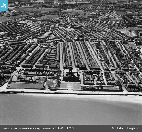
EAW001716 ENGLAND (1946). Wallasey Town Hall and environs, Wallasey, 1946
© Copyright OpenStreetMap contributors and licensed by the OpenStreetMap Foundation. 2024. Cartography is licensed as CC BY-SA.
Nearby Images (4)
EAW001716

EPW004022

EPW004053

EAW001801

Details
| Title | [EAW001716] Wallasey Town Hall and environs, Wallasey, 1946 |
| Reference | EAW001716 |
| Date | 11-July-1946 |
| Link | |
| Place name | WALLASEY |
| Parish | |
| District | |
| Country | ENGLAND |
| Easting / Northing | 332012, 391445 |
| Longitude / Latitude | -3.0230309002421, 53.415165014391 |
| National Grid Reference | SJ320914 |
Pins
 flagermus |
Tuesday 14th of February 2023 12:27:17 PM | |
flagermus |
Tuesday 14th of February 2023 12:25:28 PM | |
flagermus |
Friday 13th of January 2023 02:33:20 PM | |
david saunders |
Thursday 25th of November 2021 04:54:23 PM | |
redmist |
Monday 7th of October 2019 11:15:43 PM | |
david saunders |
Wednesday 2nd of January 2019 10:18:42 PM | |
david saunders |
Wednesday 2nd of January 2019 10:10:16 PM | |
david saunders |
Wednesday 2nd of January 2019 10:08:00 PM | |
Sparky |
Thursday 21st of September 2017 11:48:01 PM | |
Sparky |
Thursday 21st of September 2017 11:47:08 PM | |
gBr |
Saturday 2nd of August 2014 04:57:59 PM | |
gBr |
Saturday 2nd of August 2014 04:44:45 PM | |
Roger Reid |
Tuesday 18th of February 2014 04:15:52 AM | |
Roger Reid |
Tuesday 18th of February 2014 04:15:28 AM |


