
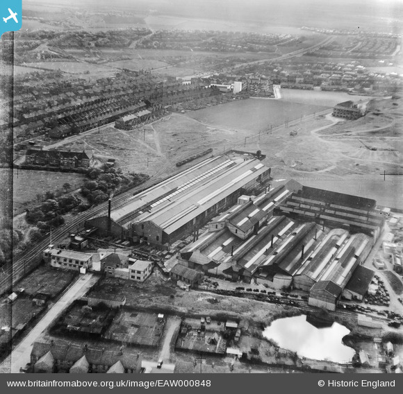
EAW000848 ENGLAND (1946). Baker Perkins Ltd Bedewell Engineering Works and environs, Monkton, 1946
© Copyright OpenStreetMap contributors and licensed by the OpenStreetMap Foundation. 2024. Cartography is licensed as CC BY-SA.
Nearby Images (17)
EAW000848

EAW000854

EAW000849

EAW000851

EAW002142

EAW002139

EAW002137

EAW002143

EAW002144

EAW002141

EAW002140

EAW000850

EAW000853

EAW000852

EAW002136

EPW019882
, Jarrow, 1927")
EPW019885
, Jarrow, 1927")
Details
| Title | [EAW000848] Baker Perkins Ltd Bedewell Engineering Works and environs, Monkton, 1946 |
| Reference | EAW000848 |
| Date | 15-May-1946 |
| Link | |
| Place name | MONKTON |
| Parish | |
| District | |
| Country | ENGLAND |
| Easting / Northing | 432257, 564457 |
| Longitude / Latitude | -1.496016232168, 54.973606364188 |
| National Grid Reference | NZ323645 |
Pins
 redmist |
Thursday 24th of October 2019 11:08:45 AM | |
only1jdw |
Wednesday 23rd of December 2015 05:42:13 PM | |
only1jdw |
Wednesday 23rd of December 2015 05:37:39 PM |


