
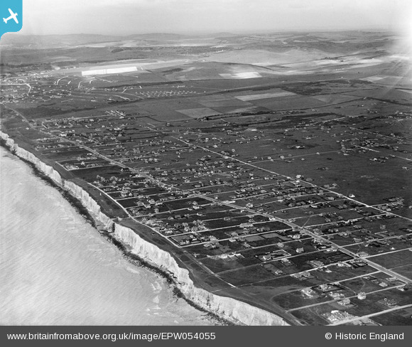
epw054055 ENGLAND (1937). Residential development, Peacehaven, from the south-east, 1937
© Hawlfraint cyfranwyr OpenStreetMap a thrwyddedwyd gan yr OpenStreetMap Foundation. 2024. Trwyddedir y gartograffeg fel CC BY-SA.
Delweddau cyfagos (3)
EPW054055

EPW041394

EPW041387

Manylion
| Pennawd | [EPW054055] Residential development, Peacehaven, from the south-east, 1937 |
| Cyfeirnod | EPW054055 |
| Dyddiad | June-1937 |
| Dolen | |
| Enw lle | PEACEHAVEN |
| Plwyf | PEACEHAVEN |
| Ardal | |
| Gwlad | ENGLAND |
| Dwyreiniad / Gogleddiad | 541179, 100954 |
| Hydred / Lledred | 0.0032299129835924, 50.790374543924 |
| Cyfeirnod Grid Cenedlaethol | TQ412010 |
Pinnau
Byddwch y cyntaf i ychwanegu sylw at y ddelwedd hon!
Cyfraniadau Grŵp
 Peacehaven |
 Alan McFaden |
Friday 7th of November 2014 09:57:30 AM |
 Peacehaven |
Alan McFaden |
Friday 7th of November 2014 09:57:08 AM |
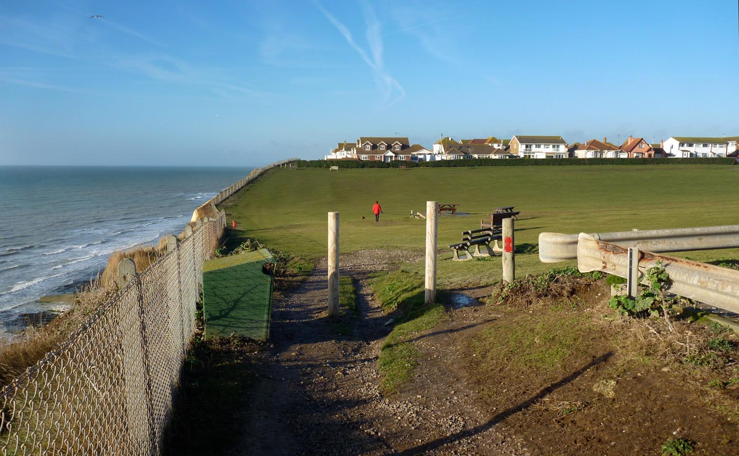
Peacehaven view from the Cliffs |
Alan McFaden |
Friday 7th of November 2014 09:56:49 AM |
 Paecehaven view from the Cliffs |
Alan McFaden |
Friday 7th of November 2014 09:56:20 AM |
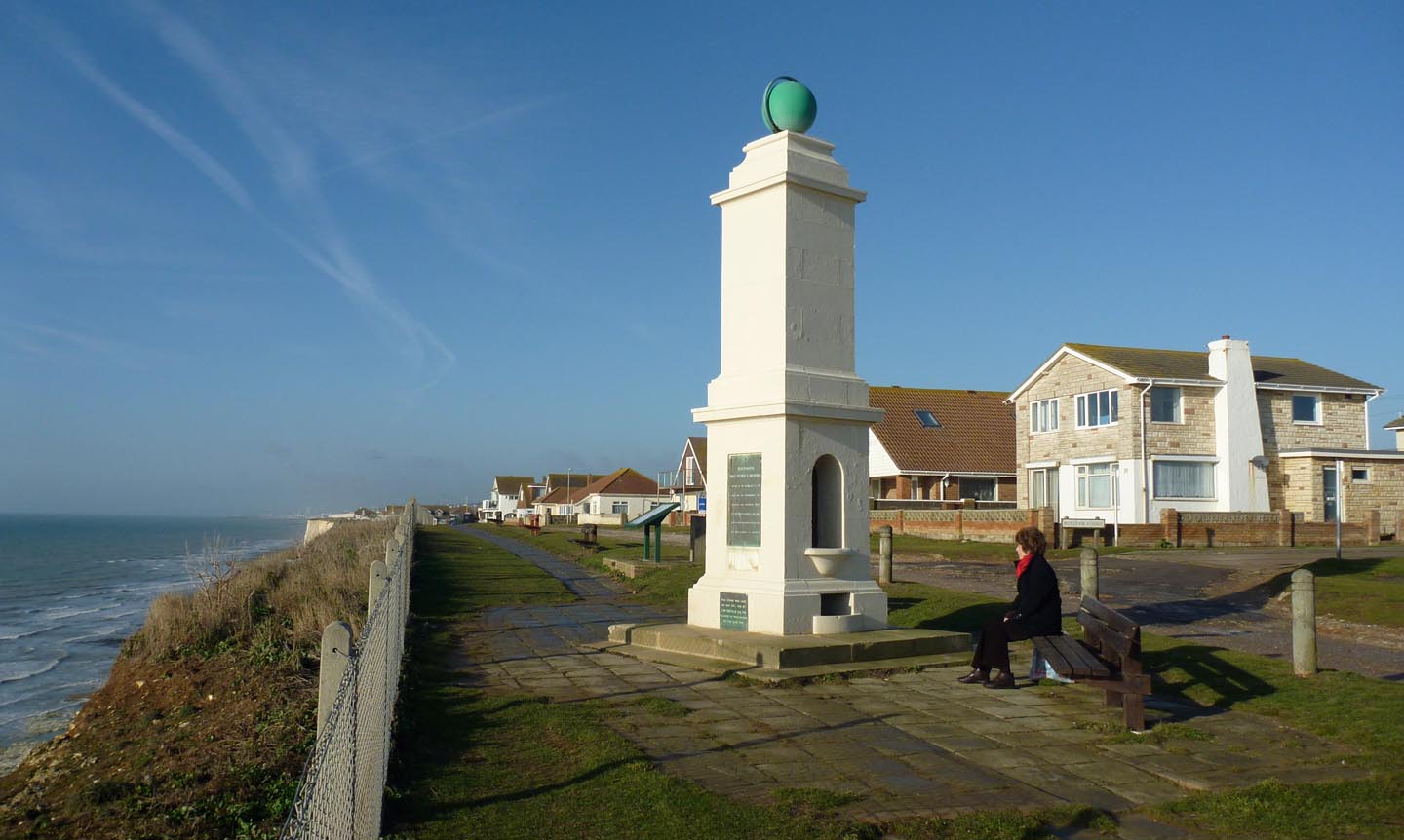 Pacehaven Meridian Line Marker |
Alan McFaden |
Friday 7th of November 2014 09:55:47 AM |


