
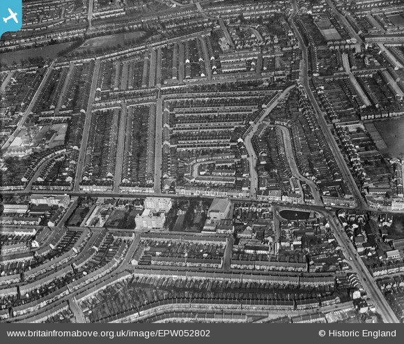
epw052802 ENGLAND (1937). London Road, Raymead Avenue and surrounding residential area, Thornton Heath, 1937
© Hawlfraint cyfranwyr OpenStreetMap a thrwyddedwyd gan yr OpenStreetMap Foundation. 2024. Trwyddedir y gartograffeg fel CC BY-SA.
Delweddau cyfagos (2)
EPW052802

EPW060794

Manylion
| Pennawd | [EPW052802] London Road, Raymead Avenue and surrounding residential area, Thornton Heath, 1937 |
| Cyfeirnod | EPW052802 |
| Dyddiad | 3-April-1937 |
| Dolen | |
| Enw lle | THORNTON HEATH |
| Plwyf | |
| Ardal | |
| Gwlad | ENGLAND |
| Dwyreiniad / Gogleddiad | 531336, 168024 |
| Hydred / Lledred | -0.1119539066869, 51.395534565406 |
| Cyfeirnod Grid Cenedlaethol | TQ313680 |
Pinnau
 Nowy Paul |
Sunday 5th of May 2019 04:50:33 PM | |
Nowy Paul |
Sunday 5th of May 2019 04:47:56 PM | |
RBMcN |
Thursday 3rd of September 2015 10:54:43 AM | |
RBMcN |
Thursday 3rd of September 2015 10:53:47 AM | |
RBMcN |
Thursday 3rd of September 2015 10:52:37 AM | |
 Class31 |
Sunday 25th of January 2015 11:22:14 AM | |
Class31 |
Sunday 25th of January 2015 11:21:42 AM | |
Class31 |
Sunday 25th of January 2015 11:20:30 AM | |
Class31 |
Sunday 25th of January 2015 11:20:02 AM |


