
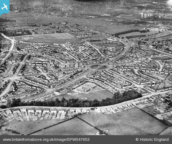
epw047653 ENGLAND (1935). Housing development at Hallam Crescent East and Coalpit Lane and environs, Braunstone Park, 1935
© Hawlfraint cyfranwyr OpenStreetMap a thrwyddedwyd gan yr OpenStreetMap Foundation. 2024. Trwyddedir y gartograffeg fel CC BY-SA.
Delweddau cyfagos (2)
EPW047653

EPW047652

Manylion
| Pennawd | [EPW047653] Housing development at Hallam Crescent East and Coalpit Lane and environs, Braunstone Park, 1935 |
| Cyfeirnod | EPW047653 |
| Dyddiad | June-1935 |
| Dolen | |
| Enw lle | BRAUNSTONE PARK |
| Plwyf | |
| Ardal | |
| Gwlad | ENGLAND |
| Dwyreiniad / Gogleddiad | 456445, 302579 |
| Hydred / Lledred | -1.1661806493448, 52.617690279174 |
| Cyfeirnod Grid Cenedlaethol | SK564026 |
Pinnau
 pat lennon |
Thursday 2nd of February 2023 12:45:48 PM | |
AlanH |
Thursday 6th of August 2015 10:56:58 AM | |
Carmedic |
Wednesday 12th of November 2014 02:07:42 PM |


