
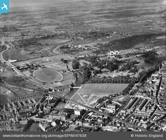
epw047638 ENGLAND (1935). Abbey Park and environs, Leicester, from the south-west, 1935
© Hawlfraint cyfranwyr OpenStreetMap a thrwyddedwyd gan yr OpenStreetMap Foundation. 2024. Trwyddedir y gartograffeg fel CC BY-SA.
Delweddau cyfagos (5)
EPW047638

EAW052696

EAW052694

EAW052693

EAW052697

Manylion
| Pennawd | [EPW047638] Abbey Park and environs, Leicester, from the south-west, 1935 |
| Cyfeirnod | EPW047638 |
| Dyddiad | June-1935 |
| Dolen | |
| Enw lle | LEICESTER |
| Plwyf | |
| Ardal | |
| Gwlad | ENGLAND |
| Dwyreiniad / Gogleddiad | 458282, 305409 |
| Hydred / Lledred | -1.1385478102957, 52.642937218572 |
| Cyfeirnod Grid Cenedlaethol | SK583054 |
Pinnau
 gBr |
Tuesday 26th of January 2016 06:46:44 PM | |
gBr |
Tuesday 26th of January 2016 06:43:33 PM | |
diag |
Sunday 22nd of September 2013 07:21:48 PM |


