
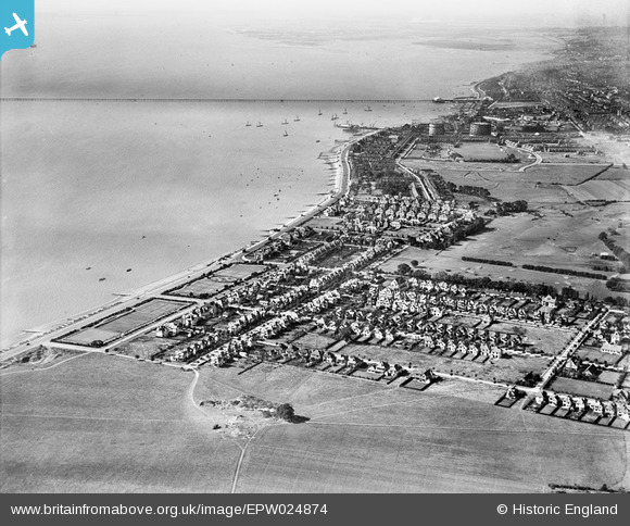
epw024874 ENGLAND (1928). Canvey Point and Southend Pier seen from Southchurch, Southend-on-Sea, from the north-east, 1928
© Hawlfraint cyfranwyr OpenStreetMap a thrwyddedwyd gan yr OpenStreetMap Foundation. 2024. Trwyddedir y gartograffeg fel CC BY-SA.
Delweddau cyfagos (2)
EPW024874

EPW036699

Manylion
| Pennawd | [EPW024874] Canvey Point and Southend Pier seen from Southchurch, Southend-on-Sea, from the north-east, 1928 |
| Cyfeirnod | EPW024874 |
| Dyddiad | 3-October-1928 |
| Dolen | |
| Enw lle | SOUTHEND-ON-SEA |
| Plwyf | |
| Ardal | |
| Gwlad | ENGLAND |
| Dwyreiniad / Gogleddiad | 591564, 184917 |
| Hydred / Lledred | 0.76210936966349, 51.530134488861 |
| Cyfeirnod Grid Cenedlaethol | TQ916849 |
Pinnau
 Sara |
Thursday 18th of January 2024 07:04:33 PM | |
Bazza |
Saturday 18th of April 2020 04:23:49 PM | |
bargee1937 |
Tuesday 7th of July 2015 08:31:54 PM | |
bargee1937 |
Thursday 25th of June 2015 10:55:39 AM | |
bargee1937 |
Thursday 25th of June 2015 10:53:21 AM |


