
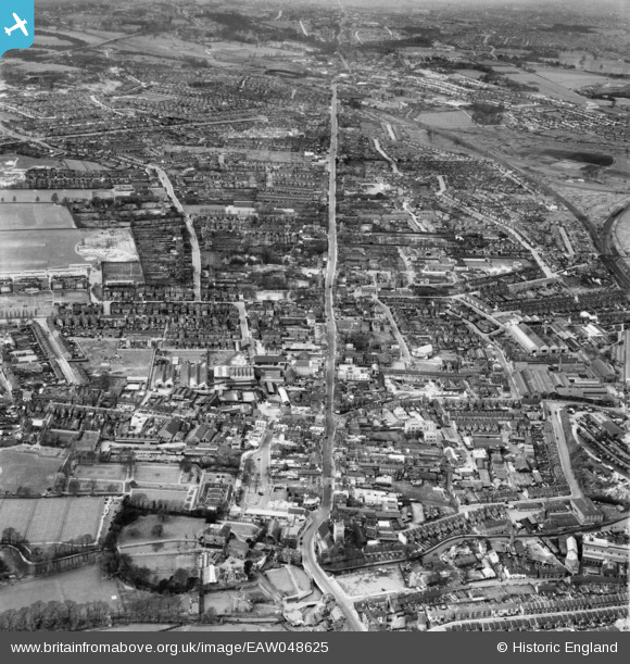
eaw048625 ENGLAND (1953). High Street, Spital Street and the town, Dartford, from the east, 1953
© Hawlfraint cyfranwyr OpenStreetMap a thrwyddedwyd gan yr OpenStreetMap Foundation. 2024. Trwyddedir y gartograffeg fel CC BY-SA.
Delweddau cyfagos (12)
EAW048625

EAW048627

EAW048624

EPW028231

EPW057058

EPW028230

EPW028229

EPW028228

EPW045633

EPW045632

EPW028234

EPW021978

Manylion
| Pennawd | [EAW048625] High Street, Spital Street and the town, Dartford, from the east, 1953 |
| Cyfeirnod | EAW048625 |
| Dyddiad | 3-April-1953 |
| Dolen | |
| Enw lle | DARTFORD |
| Plwyf | |
| Ardal | |
| Gwlad | ENGLAND |
| Dwyreiniad / Gogleddiad | 554223, 174026 |
| Hydred / Lledred | 0.21942922376573, 51.443707800393 |
| Cyfeirnod Grid Cenedlaethol | TQ542740 |
Pinnau
 Nowy Paul |
Sunday 3rd of December 2017 01:12:04 PM | |
alastair wallace |
Saturday 21st of November 2015 12:49:06 AM | |
sednamoon |
Tuesday 2nd of September 2014 11:23:25 PM |


