
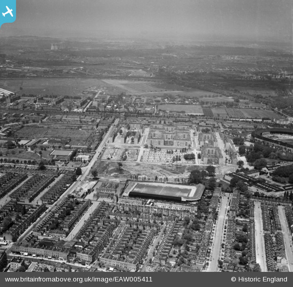
eaw005411 ENGLAND (1947). The White City Estate and Loftus Road Football Ground, Shepherd's Bush, from the south, 1947
© Hawlfraint cyfranwyr OpenStreetMap a thrwyddedwyd gan yr OpenStreetMap Foundation. 2024. Trwyddedir y gartograffeg fel CC BY-SA.
Delweddau cyfagos (7)
EAW005411

EPW022720

EPW022719

EPW062152

EAW005413

EAW005410

EPW022570

Manylion
| Pennawd | [EAW005411] The White City Estate and Loftus Road Football Ground, Shepherd's Bush, from the south, 1947 |
| Cyfeirnod | EAW005411 |
| Dyddiad | 17-May-1947 |
| Dolen | |
| Enw lle | SHEPHERD'S BUSH |
| Plwyf | |
| Ardal | |
| Gwlad | ENGLAND |
| Dwyreiniad / Gogleddiad | 522738, 180439 |
| Hydred / Lledred | -0.23118239823774, 51.509049955796 |
| Cyfeirnod Grid Cenedlaethol | TQ227804 |
Pinnau
 redmist |
Tuesday 26th of December 2023 01:34:17 PM | |
redmist |
Tuesday 26th of December 2023 01:30:22 PM |


