
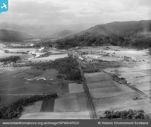
SPW040510 SCOTLAND (1932). Aviemore, general view, showing River Spey and Craigellachie. An oblique aerial photograph taken facing south-west.
© Hawlfraint cyfranwyr OpenStreetMap a thrwyddedwyd gan yr OpenStreetMap Foundation. 2024. Trwyddedir y gartograffeg fel CC BY-SA.
Manylion
| Pennawd | [SPW040510] Aviemore, general view, showing River Spey and Craigellachie. An oblique aerial photograph taken facing south-west. |
| Cyfeirnod | SPW040510 |
| Dyddiad | 1932 |
| Dolen | Canmore Collection item 1257536 |
| Enw lle | |
| Plwyf | DUTHIL AND ROTHIEMURCHUS |
| Ardal | BADENOCH AND STRATHSPEY |
| Gwlad | SCOTLAND |
| Dwyreiniad / Gogleddiad | 289796, 812915 |
| Hydred / Lledred | -3.8239226142408, 57.19395222798 |
| Cyfeirnod Grid Cenedlaethol | NH898129 |
Pinnau
 areed |
Saturday 4th of July 2020 06:41:26 PM | |
areed |
Saturday 4th of July 2020 06:41:00 PM | |
areed |
Saturday 4th of July 2020 06:40:49 PM | |
areed |
Saturday 4th of July 2020 06:40:38 PM | |
areed |
Saturday 4th of July 2020 06:40:14 PM | |
areed |
Saturday 4th of July 2020 06:39:17 PM | |
areed |
Saturday 4th of July 2020 06:36:40 PM | |
areed |
Saturday 4th of July 2020 06:36:20 PM | |
areed |
Saturday 4th of July 2020 06:33:45 PM | |
areed |
Saturday 4th of July 2020 06:33:34 PM | |
 Mounthooly |
Sunday 1st of July 2012 05:07:33 PM |
Cyfraniadau Grŵp
yep, wrong Craigellachie wrt the distillery. Though the hill on right hand side across upper third, is called Craigellachie. Its a National Nature Reserve and is on the boundary between Badenoch and Strathspey. |
PeteM |
Friday 12th of April 2013 11:32:50 PM |
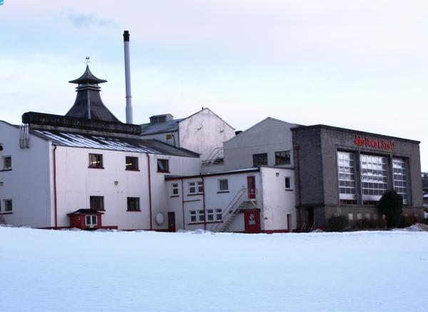
 Craigellachie Distillery |
Mounthooly |
Sunday 1st of July 2012 05:08:11 PM |
Aviemore and Craigellachie are 37 miles apart, so I don't think you can see Craigellachie in this photo. |
darkeyedmary |
Tuesday 26th of June 2012 11:42:05 PM |


