
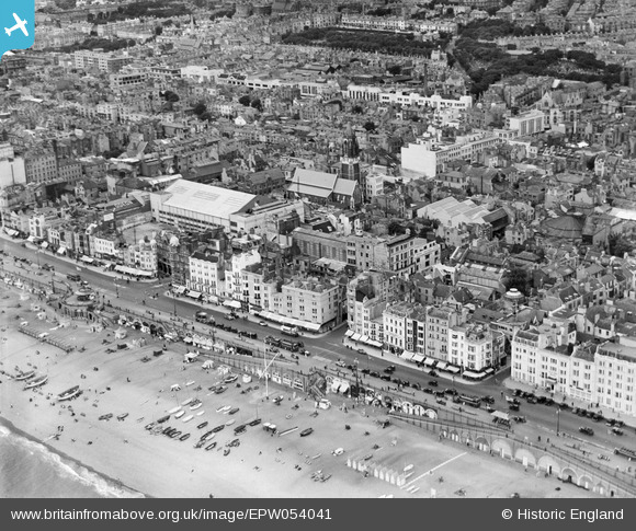
EPW054041 ENGLAND (1937). King's Road and the town, Brighton, from the south-east, 1937
© Hawlfraint cyfranwyr OpenStreetMap a thrwyddedwyd gan yr OpenStreetMap Foundation. 2024. Trwyddedir y gartograffeg fel CC BY-SA.
Delweddau cyfagos (6)
EPW054041

EPW016878

EPW000723

EPW039530

EPW054039

EAW022260

Manylion
| Pennawd | [EPW054041] King's Road and the town, Brighton, from the south-east, 1937 |
| Cyfeirnod | EPW054041 |
| Dyddiad | June-1937 |
| Dolen | |
| Enw lle | BRIGHTON |
| Plwyf | |
| Ardal | |
| Gwlad | ENGLAND |
| Dwyreiniad / Gogleddiad | 530865, 103974 |
| Hydred / Lledred | -0.14195633345461, 50.819941629921 |
| Cyfeirnod Grid Cenedlaethol | TQ309040 |
Pinnau
 Tom |
Friday 23rd of February 2018 05:04:27 PM | |
 Alan McFaden |
Friday 15th of November 2013 05:24:47 PM | |
Alan McFaden |
Monday 9th of September 2013 12:15:20 PM | |
Alan McFaden |
Monday 9th of September 2013 12:13:39 PM |


