
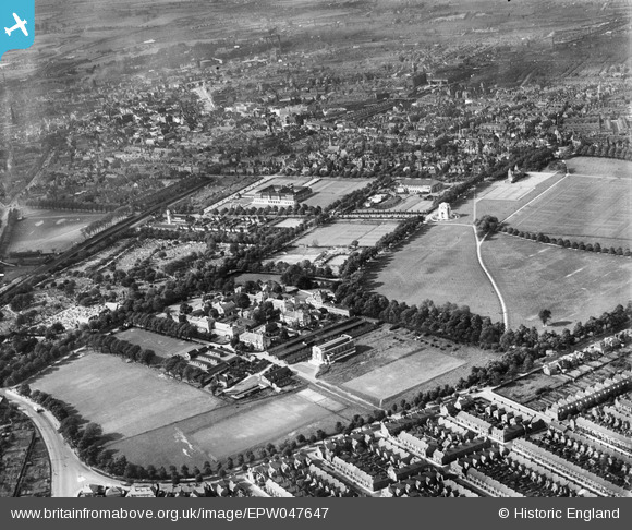
EPW047647 ENGLAND (1935). Victoria Park, University College Leicester and Welford Road Cemetery, Leicester, from the south-east, 1935
© Hawlfraint cyfranwyr OpenStreetMap a thrwyddedwyd gan yr OpenStreetMap Foundation. 2024. Trwyddedir y gartograffeg fel CC BY-SA.
Delweddau cyfagos (6)
EPW047647

EPW047648

EPW047646

EPW047649

EPW014911

EPW055017

Manylion
| Pennawd | [EPW047647] Victoria Park, University College Leicester and Welford Road Cemetery, Leicester, from the south-east, 1935 |
| Cyfeirnod | EPW047647 |
| Dyddiad | June-1935 |
| Dolen | |
| Enw lle | LEICESTER |
| Plwyf | |
| Ardal | |
| Gwlad | ENGLAND |
| Dwyreiniad / Gogleddiad | 459404, 302698 |
| Hydred / Lledred | -1.12245362438, 52.61844436858 |
| Cyfeirnod Grid Cenedlaethol | SK594027 |
Pinnau
 Underwood55 |
Tuesday 15th of October 2013 11:53:17 PM | |
JCC |
Friday 14th of June 2013 05:48:09 PM |


